Sharing Datasets
Once you have a dataset in Geodesic, it is easy to share out to other GIS workflows, or simply to a Python environment. Here, we will share the Overture Foundation Building Footprints dataset to an ArcGIS map. First, we find the dataset in the Global graph with a quick search for "overture".
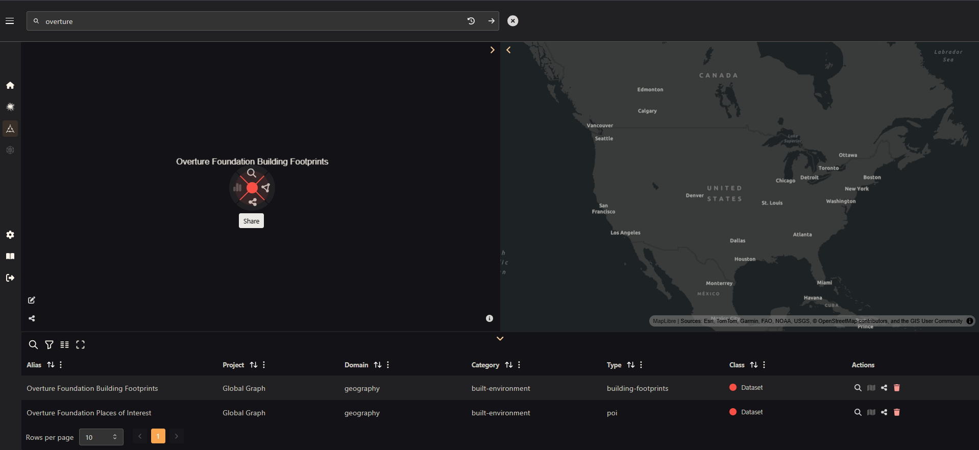
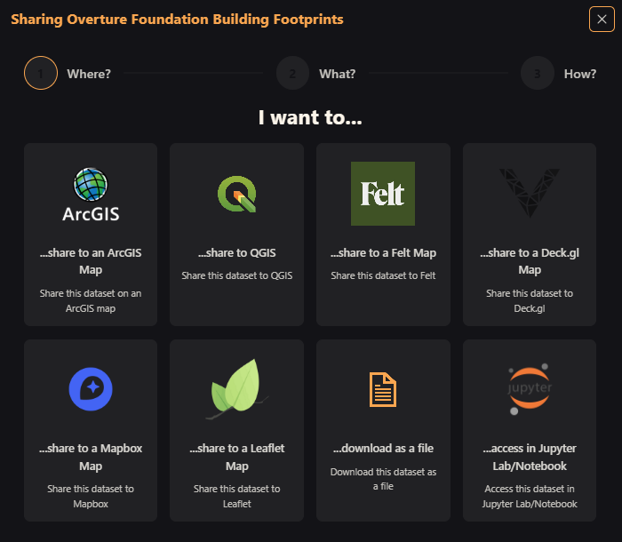
Click on the node to bring up the radial menu, then select "Share" to bring up the dataset share wizard. On this first page, you can choose how you would like to share your data. We will click on "ArcGIS".
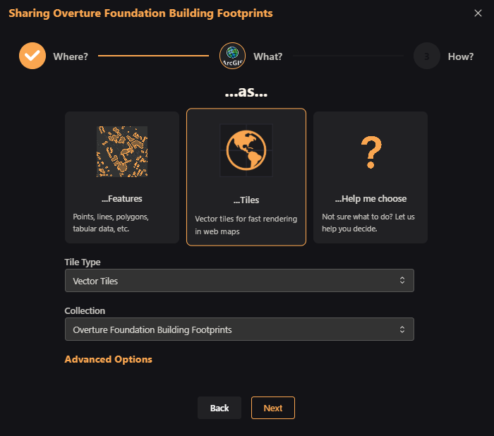
For a feature dataset such as this, you will have the option to share as features or to share as tiles. Because it is a large dataset, and we are just going to share it to a map, it makes sense to use vector tiles, so that's what we select.
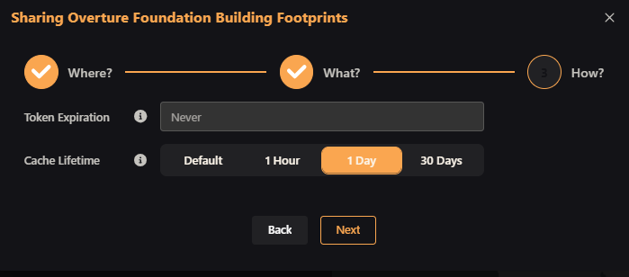
Finally, we choose an expiration for the share token (never, by default), and optionally can add caching to the shared dataset. We choose a 1-day cache.
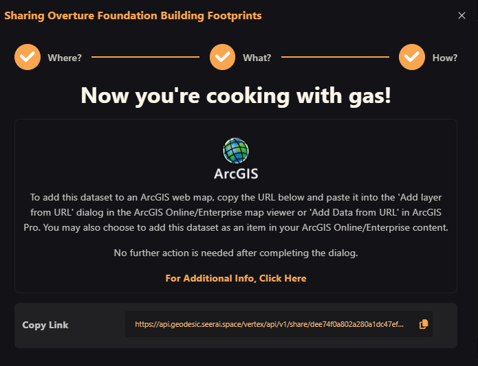
And that's it. The final dialog box will appear with a copiable link and some instructions.
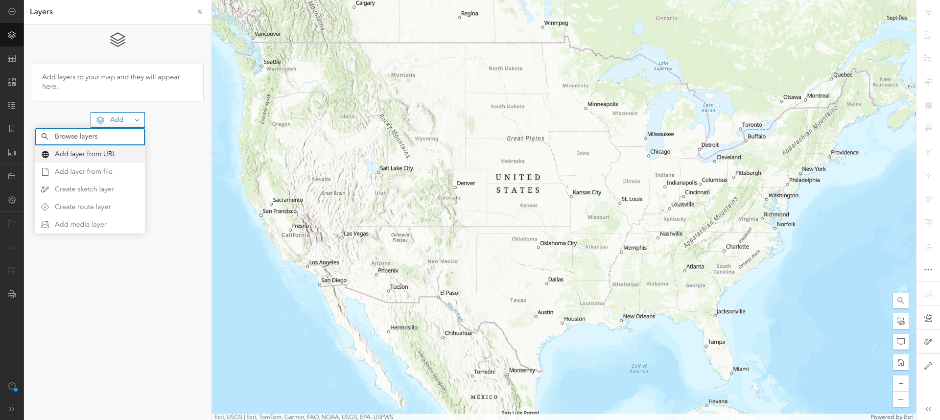
Now, we take that link to ArcGIS online. We open a new map and click "Add > Add Layer from URL".
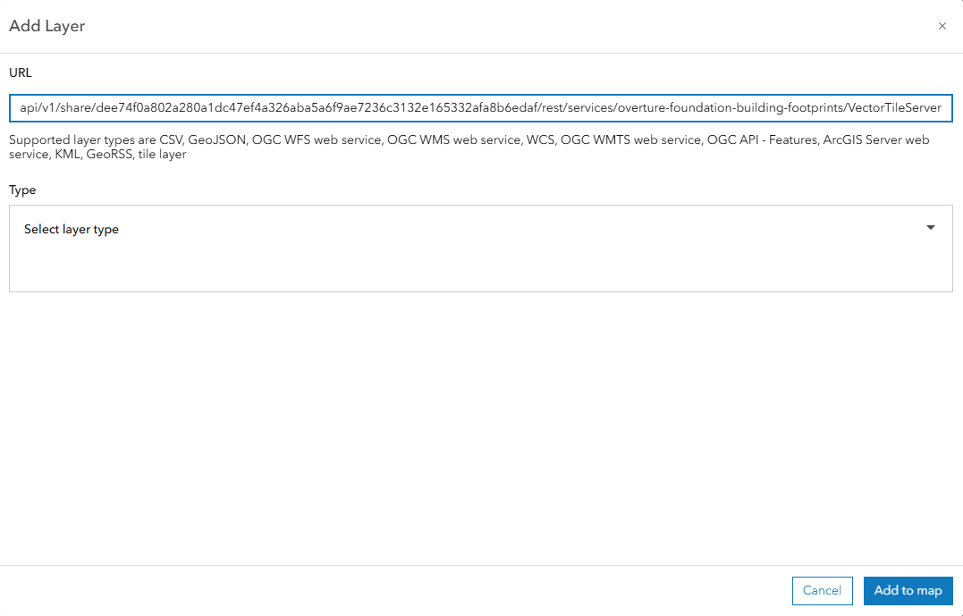
We paste the share token URL into the URL field and click "Add to map".
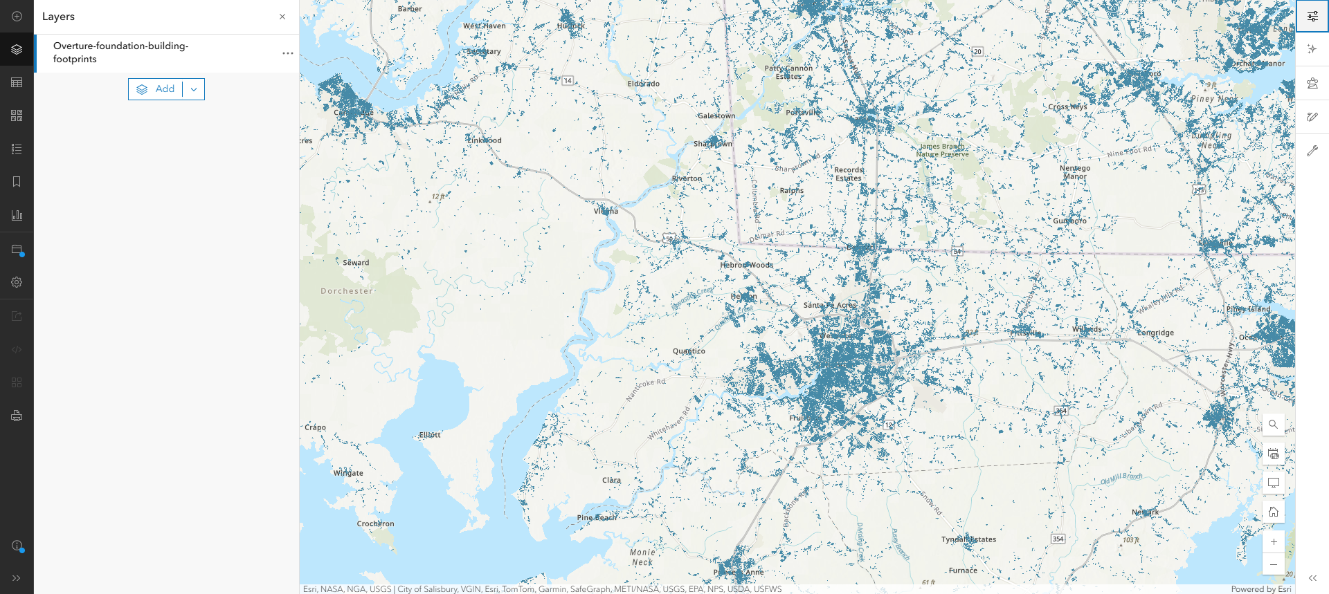
And now we have building footprint tiles on an ArcGIS map!
Next Steps
Learn More about Sharing Datasets
To learn more about sharing datasets, such as sharing to different services, sharing raster datasets and so on, click below to go to the Dataset Sharing Tutorial.